Jotunheimen 2026
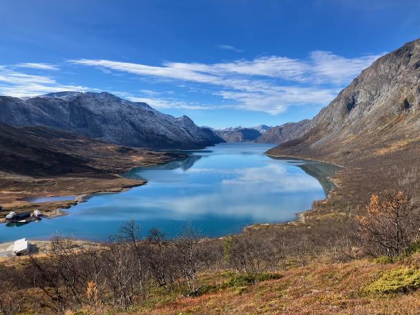
This travel started with a message from a good friend of mine who I haven’t seen for years: “I’ve been planning a hike with my brother, but if you are interested, we could coordinate something”. Norway was on my radar since the roadtrip in 2011, but as I am not a big fan of being wet or freezing – I kept postponing it. And this looked like a good opportunity to get two birds with one stone – to go for a hike I wouldn’t normally go by myself; and to hang out with a friend I haven’t seen in person since China in 2019.
Jotunheimen came up semi-randomly. It is accessible by bus from Oslo within a reasonable commute of 4–5 hours. It is small enough to walk around it for a few days and get to see a significant part of the national park. It has plenty of trails to choose from and adjust our route as we go, depending on the weather, trail conditions, our mood and so on. It seemed to be popular enough destinations to be well managed, while off-season enough to be not crowded. And it just sounds cool – both literally, figuratively and mythologically. All the best parts.
The original plan was to go for a five days hike – short first and last days and three full days in-between. Then we messed up the dates while buying the flight tickets, and the route got shortened to just four days instead, Friday to Monday. The tricky part of the route planning being - the official season was ending on Sunday, with no more buses bound for Gjendesheim from Monday onward. So the plan was to start from Gjendesheim on Friday and to finish in Beitostølen on Monday, as the buses through the village go reliably all year round. We roughly drafted a few routes of different difficulty we could take within the time we had with a given starting and finishing points. And we set Glitterheim as a stretch goal for the first day, so that we could take a good look at Glittertind and decide if we want to climb it or walk around it.
Practically, we underestimated the mountains in October, overestimated ourselves and came slightly underprepared. On the other hand, we were blessed with the weather being as good as it gets, and we were flexible enough to adapt and adjust to the situation on the go. So it ended up being a tough but delightful experience – the kind that makes one think “what am I even doing here?” at least once or twice in the process, but stays a good memory and a fun story to tell afterwards.
Jotunheimen is a mountainous area in the Southern Norway: still north from Oslo or Bergen, but south of Ålesund or Trondheim. It is a part of the range of Scandinavian Mountains and 29 highest mountains in Norway are all located in the Jotunheimen. The area offers more than 50 marked trails of varying length, allowing short day-hikes, strenuous multi-day trekking and mountaineering. Originally the area had no common name, until it was named Jotunheimen in the 19th century, with a name being a reference to Jötunheimr of the Norse mythology.
Jotunheimen National Park was established by Royal Decree in 1980 and it covers roughly a third of the total area of Jotunheimen, with a few other national parks being adjacent to it. More than 250 peaks in the national park rise above 1900m, including the three highest peaks of the Northern Europe: Galdhøpiggen (2469m), Glittertind (2452m) and Store Skagastølstind (2405m). While some of the trails in Jotunheimen are only accessible with the right gear, technical skills and a local guide, there are plenty of the trails that are available for unguided walks with different levels of technical and physical difficulty. The national park has a number of manned and unmanned DNT huts, as well as plenty of good camping spots.